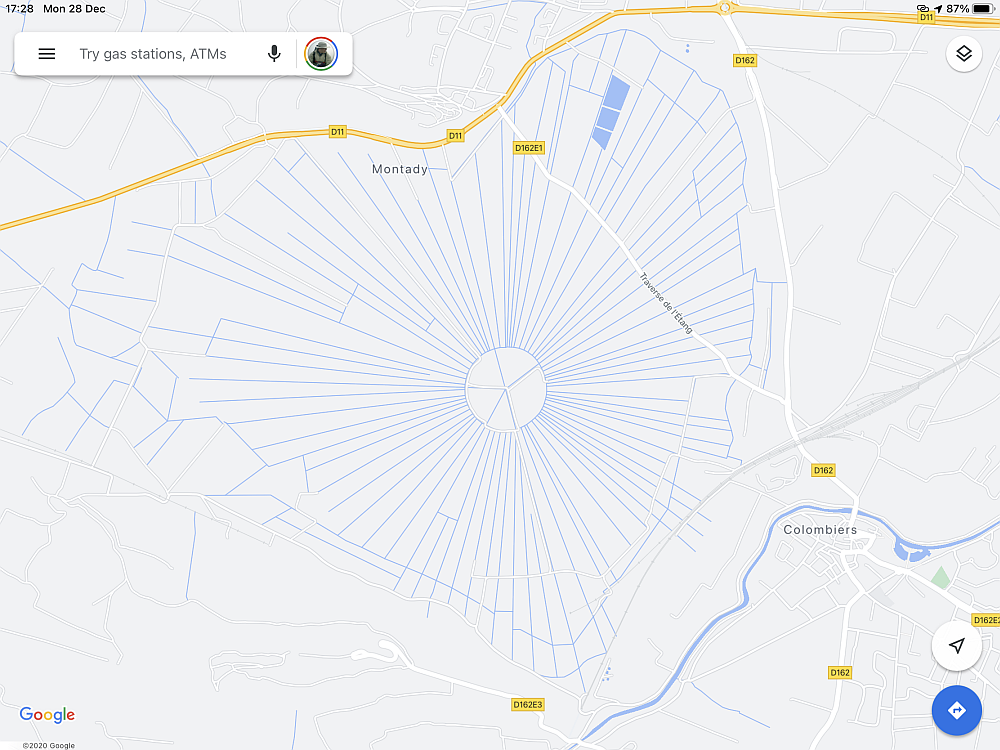
While scoping out the area near Béziers in the south of France on Google Maps, my eyes spotted this interesting thing:
Was this a special French signal to extraterrestrials? Was this perhaps a secret French nuclear installation? I had to check it out!
Well, as you can see from the snippet in Google Maps, not only can you check it out but in fact there is a small, one-lane farm road that lets you drive right through it! Here’s what I saw, rows and rows of drainage ditches:
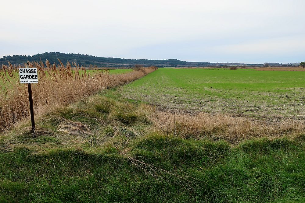
Indeed, there were a series of drainage ditches – all filled with water – that were feeding radially into a center point. I spotted a nearby hill – at the top of which, coincidentally, is a Roman archeological site called L’Oppidum d’Énsérune, and from that place you can really see how huge this place is:
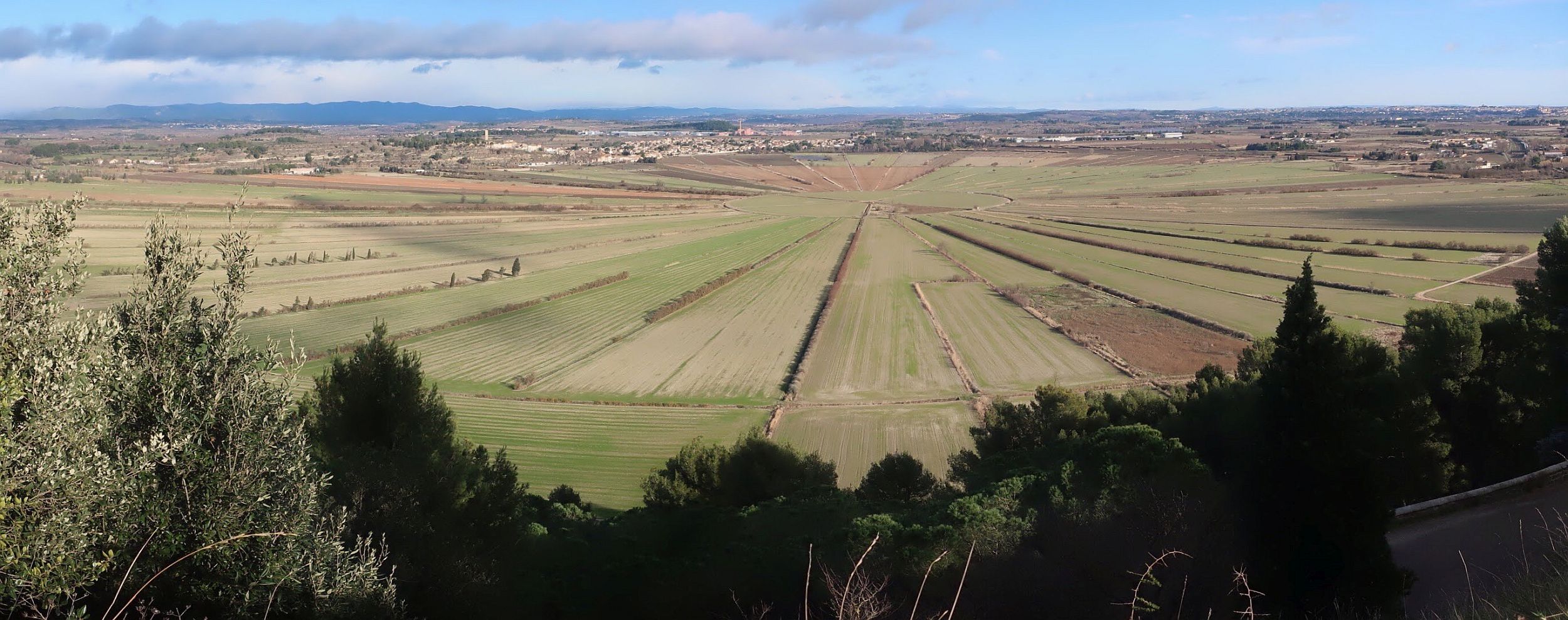
I discovered a bit more on Wikipedia. Turns out that this site dates back to the thirteenth century! Originally this land was a swamp, and they created this pattern in order to drain the swamp. I would have loved to walk into the center of the installation, but there were a number of “private property” signs – and, to be honest, I was a bit worried I might accidentally fall into some type of a sink hole, or perhaps into one of the “sixteen vertical shafts” that Wikipedia talks about – so I’ll leave that on my bucket list for a later date.